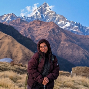
1. Quick Facts about the Great Himalayan Trail
- Distance Covered: Approximately 1,700 kilometers
- Duration: 4 to 6 months for the full trek; 2 to 4 weeks for individual sections.
- Highest Point: Over 6,000 meters at some technical passes.
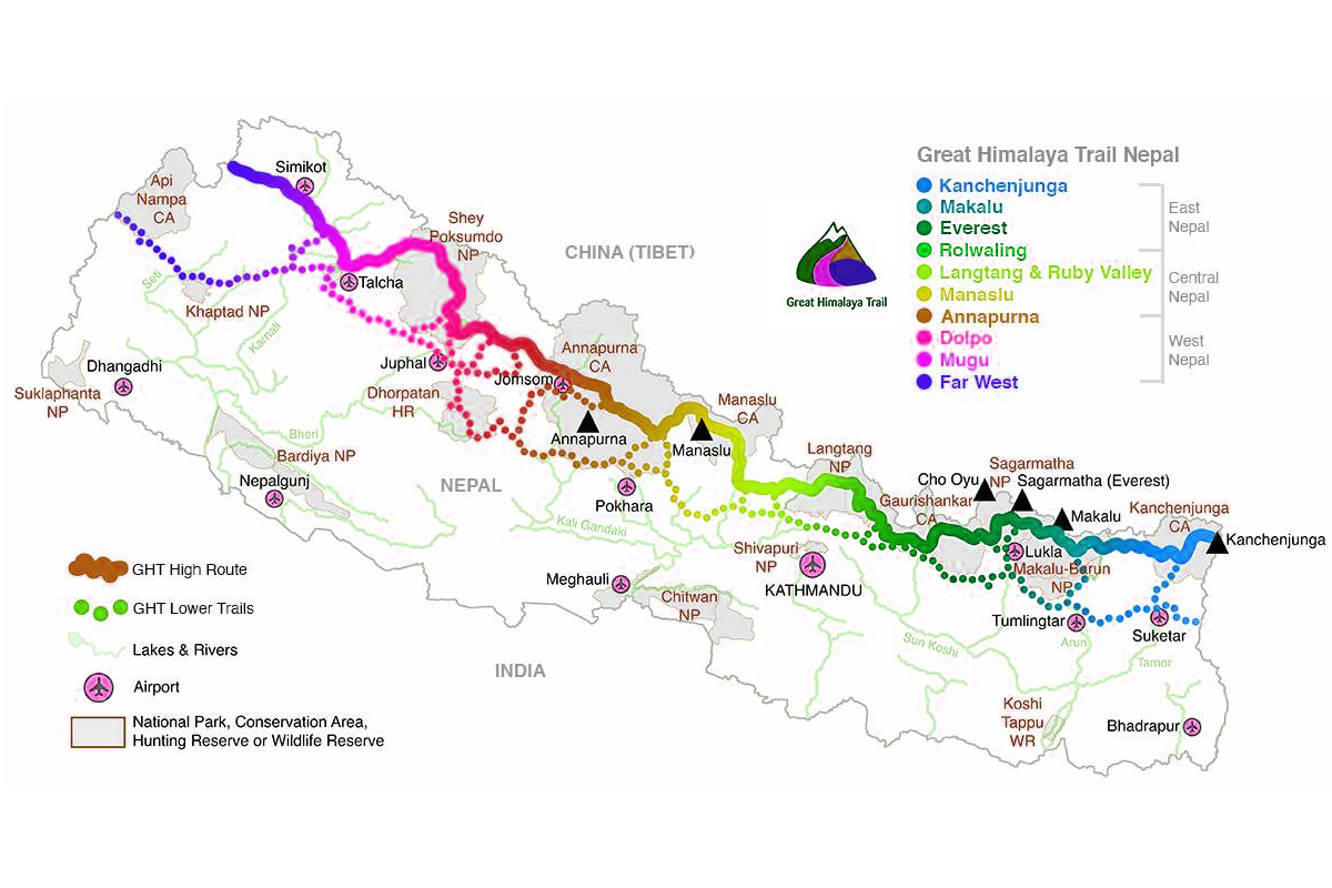
- Regions Travelled: 10 major trekking regions including Kanchenjunga, Makalu, Everest, Langtang, Manaslu, Annapurna, Dhaulagiri, Dolpo, and more.
- Route Types: High Route (technical, high-altitude passes) and Low Route (cultural, lower-altitude).
- Best Season: Spring (March-May) and Autumn (September-November).
- Difficulty: Extremely challenging due to altitude, remoteness, and weather.
/potter.jpg)
2. What Makes the Great Himalayan Trail Difficult & Why Do So Many Hikers Fail?
Undertaking the Great Himalayan Trail is not like trekking in popular regions like Everest or Annapurna. The GHT tests your physical strength, mental ability, and willpower in ways that few other treks can. Here are some reasons why so many hikers fail to complete the GHT:
A. Altitude
Many sections of the High Route cross high-altitude passes over 5,000 meters, and a few push above 6,000 meters. The constant exposure to high altitudes significantly increases the risk of Acute Mountain Sickness (AMS). Many hikers, despite their fitness, are forced to abandon the trek due to altitude-related issues. Proper acclimatization is essential, and the trekker must listen to their body to prevent life-threatening conditions.

B. Weather and Climate
The weather in the Himalayas is highly unpredictable. Blizzards, snowstorms, avalanches and heavy rainfall can strike without warning, even during the best trekking seasons. In the High Route of Great Himalayan Trail, extreme cold and sudden snowfalls often make some passes impassable. Trekkers must be prepared for the different range of weather conditions, from searing heat in the lower regions to freezing temperatures at high altitudes.
C. Remoteness and Isolation
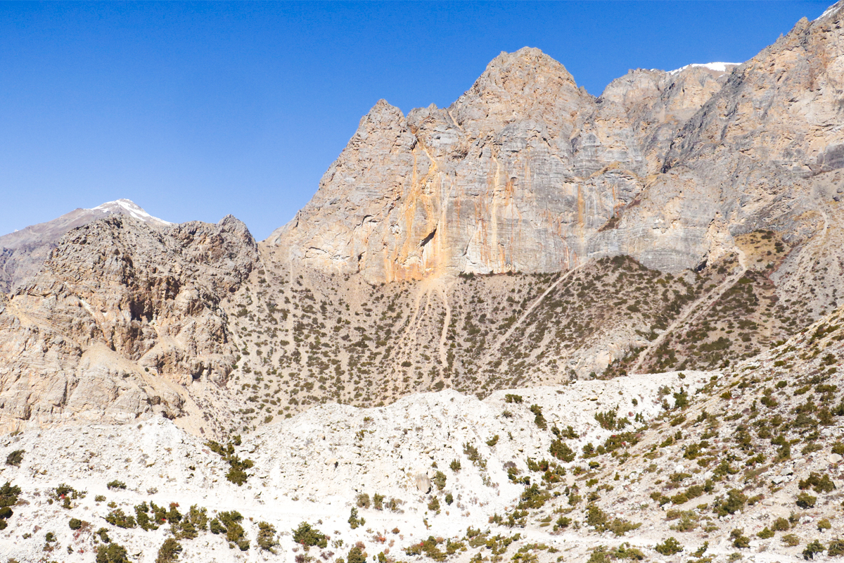
Unlike the more commercialized trekking trails in Nepal, much of the Great Himalayan Trail passes through isolated and remote areas. Some sections, especially in the west, are several days’ walks from the nearest settlement or road. This means trekkers need to be self-sufficient, carrying enough food and equipment to survive in the wilderness. The logistical challenges of managing resupply points are one of the reasons many hikers struggle to complete the trail.
D. Physical and Mental Endurance
The GHT requires sustained physical endurance over months of trekking. Daily hikes of 6-8 hours across rough terrain, coupled with the demands of high altitude and the mental strain of isolation, can wear down even the most experienced trekkers. It is not just a test of fitness but also of mental resilience. Being prepared to face long stretches of solitude is crucial for completing the trail.
E. Gear Guide
Choosing the right gear for the Great Himalayan Trail is crucial for your comfort and safety, particularly in high-altitude environments.
I. Essential Gear
- Backpack: Large enough to carry multi-day supplies but light enough for long-distance trekking.
- Sleeping Bag: Rated for -15°C to -20°C to handle cold nights in the high mountains.
- Trekking Poles: Essential for balance on rugged terrain and reducing strain on knees during long descents.
II. High-Altitude Clothing
- Base Layers: Moisture-wicking and warm.
- Mid-Layers: Insulating fleece or down jacket.
- Outer Shell: Waterproof and windproof for protection against the elements.
II. Navigation
Navigating the GHT can be particularly challenging, especially on the High Route, where trials are often unmarked, and it is easy to lose your way. Having reliable navigation tools is essential to successfully completing the trek.
IV. Resources for Navigating the GHT
- GPS Devices: A handheld GPS or a smartphone app (e.g., Gaia GPS, Maps.me) with downloadable offline maps is a must. Make sure to carry extra power banks to keep your device charged.
- Topographic Maps: Having detailed topographic maps of the region is essential for navigating less-traveled areas. Although many maps of Nepal are available, be sure they are up-to-date, as trails can change due to landslides or other factors.
- Trekking Guides: Trekkers used to hire a local guide, especially for more remote and challenging sections of the GHT. However, as per 2023, it is highly recommended to hire a guide or a porter. Having a guide significantly reduces the risk of getting lost or any potential risk.
3. Best Time for Great Himalayan Trail
The ideal time to tackle the GHT is during the spring (March-May) and autumn (September-November) seasons in Nepal. These months offer stable weather, clear skies, and moderate temperatures.
- Spring (March-May): The landscape is lush, with rhododendrons blooming, and the weather is relatively mild. However, snow can still block some high passes.
- Autumn (September-November): The post-monsoon season brings cooler temperatures and the clearest skies, offering stunning views of the mountains.
- Trekking in the monsoon season (June-August) is not recommended, especially on the High Route, due to the risk of landslides, leeches, and swollen rivers. The winter season (December-February) presents harsh cold and snow, with many high-altitude sections becoming inaccessible.
4. Choosing a Route: High Route VS Low Route
I. High Route of the GHT
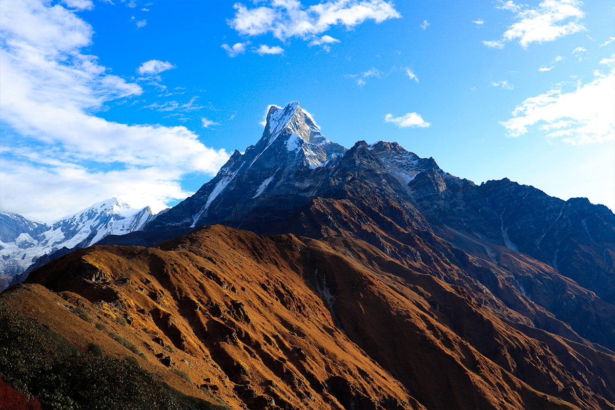
The High Route, often referred to as the "Upper" or "Extreme Route," is designed for experienced trekkers who seek a thrilling and challenging journey. It traverses through remote areas and high mountain passes, some reaching altitudes above 5,000 meters. This route takes you deep into the heart of the Himalayas, crossing some of the most rugged and isolated terrains.
Highlights of the High Route
- Panoramic views of the world’s highest peaks, including Mount Everest, Kanchenjunga, and Makalu.
- Remote villages with few tourists, providing a more intimate cultural experience.
- Crossing challenging high passes like Larkya La, Sherpani Col, and Tilman Pass.
- Exploring hidden valleys, glaciers, and pristine landscapes rarely seen by most travelers.
/Trek to annapurna circuit.jpg)
Difficulty level of high route of the GHT
- Extremely demanding with high altitudes, rough paths, and unpredictable weather.
- Requires mountaineering skills and proper acclimatization.
- Suitable for seasoned trekkers with prior high-altitude trekking experience.
- Duration: The High Route can take anywhere between 150 to 160 days to complete depending on the specific itinerary chosen and the conditions.
II. Low Route of the GHT
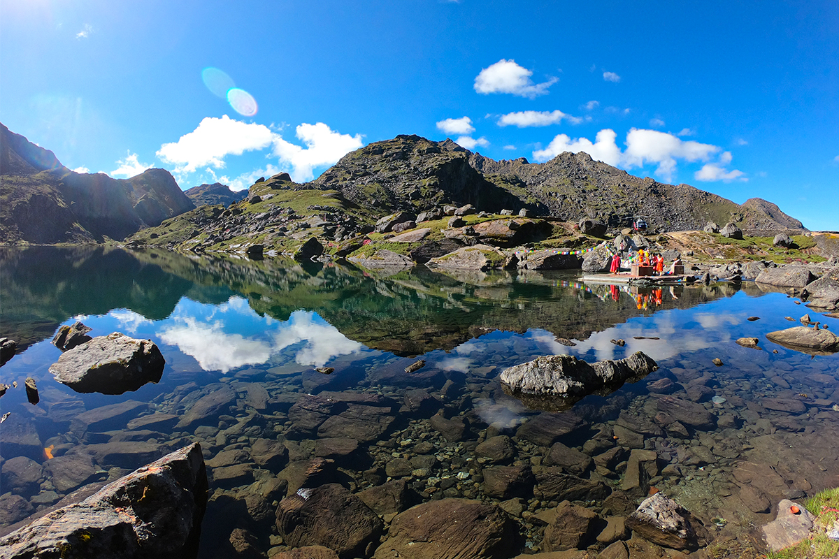
The Low Route, also called the "Cultural Trail," is a more accessible and less strenuous option compared to the High Route. It runs parallel to the High Route but sticks to the middle hills, traversing lush forests, terraced farmlands, and vibrant villages.
Highlights of the Low Route of the GHT
- Rich cultural experiences as the trail passes through traditional Nepali villages.
- Walk through verdant landscapes with rhododendron forests, waterfalls, and rivers.
- Moderate altitudes that are more manageable for most trekkers, typically below 4,000 meters.
- Interactions with diverse ethnic communities like the Sherpas, Tamangs, and Gurungs, allowing for deep cultural exchanges.
Difficulty Level of Low Route of the GHT
- Moderately difficult, with some steep ascents and descents but generally more forgiving than the High Route.
- Suitable for trekkers with basic trekking experience, though good fitness is still required.
- Duration: The Low Route generally takes about 100 to 120 days to complete, depending on the pace of the trekker and route variations.
- Technical Passes on the Great Himalayan Trail
- Technical passes are high-altitude mountain crossings that demand mountaineering skills and specialized equipment like ropes, ice axes, crampons, and sometimes, climbing knowledge. These passes are often snow-covered, icy, and steep, requiring careful navigation and attention to safety.
5. Major Technical Passes on the GHT
I. Tashi Labsta Pass (5,755 m)
Located between the Rolwaling Valley and the Khumbu region, Tashi Labsta is one of the difficult technical passes on the GHT. It included steep ascents on both sides, and the path is often covered in snow and ice. Climbers need to be familiar with glacier travel, as crevasses and icefalls are common.
II. Sherpani Col (6,135 m)
In the Makalu-Barun region, Sherpani Col is a formidable pass that links the Arun and Barun valleys. It's one of the highest and most demanding passes on the GHT, often requiring ropes to ascend and descend the steep, icy faces. Trekking this pass provides dramatic views of Mount Makalu, but it requires a high level of fitness and technical expertise.
III. West Col (6,143 m)
Near Sherpani Col, West Col connects the Makalu and Everest regions and offers a similarly difficult challenge. Trekkers must navigate steep ice and snow slopes, often necessitating the use of fixed ropes. The area is remote and can be particularly harsh due to unpredictable weather conditions, making this pass a true test for experienced trekkers.

IV. Lumbha Sambha (5,800 m)
Situated between the Dhaulagiri and Dolpo regions, Lumbha Sambha is another high-altitude pass that requires technical knowledge. The terrain is often rough, and the pass is prone to avalanches and snowstorms, so it is essential to be well-equipped and prepared for extreme weather.
V. Tilman Pass (5,308 m)
Connecting the Langtang and Panch Pokhari regions, Tilman Pass is a challenging yet rewarding crossing. It involves steep, rocky climbs and glacier travel, making it one of the more technical passes on the GHT. Proper acclimatization and strong navigation skills are crucial for trekkers attempting this pass.
6. Permits and Visas for the GHT
All foreigners, except Indian nationals, require a visa to enter Nepal. Tourist visas can be obtained on arrival at Tribhuvan International Airport in Kathmandu or at various land border crossings. Visa durations range from 15 to 90 days, with extensions available at the Department of Immigration in Kathmandu.

Required Permits
- For the GHT, trekkers need to obtain various permits depending on the regions they plan to visit. The main permits include:
- TIMS (Trekkers’ Information Management System) Card: Required for all trekkers.
- National Park/Conservation Area Permits: Depending on the region (e.g., Annapurna Conservation Area, Sagarmatha National Park).
- Restricted Area Permits (RAPs): For regions such as Upper Mustang, Upper Dolpo, and Kanchenjunga, a special permit is required. These are typically more expensive and must be arranged through a registered trekking agency.
NOTE: It is advisable to arrange permits for restricted areas, like Upper Dolpo or Kanchenjunga, before starting the trek, as they are not available along the trail. You will also need to hire a registered guide for these areas, and the permits are typically obtained through the trekking agency that organizes your guide.
7. Food and Ressupply
I. Guesthouses
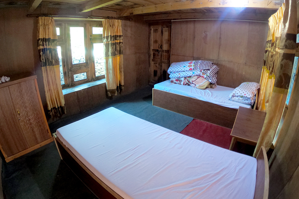
In more populated regions of the GHT, such as the Annapurna Circuit or Everest Base Camp, food and accommodation are readily available at guesthouses or teahouses. These guesthouses typically offer simple meals such as dal bhat (lentil soup with rice) and other traditional Nepali dishes. However, in remote regions, particularly on the High Route, these facilities become sparse, and trekkers must rely on self-catering.
II. Bringing Food from Home
For remote sections of the trail, trekkers need to carry dehydrated meals, snacks, and energy bars. Pre-packaged meals that can be rehydrated with hot water are convenient for areas where fresh food is not available.
III. Recommendations for Resupply Meals
It is advisable to resupply in Kathmandu or Pokhara before embarking on the trek. Stock up on high-energy foods, protein-rich snacks, and essentials like oatmeal, noodles, and dried fruit. For trekking the High Route, planning regular resupply trips to larger villages with shops is essential.
IV. Popular Shops in Nepal for Resupply
In Kathmandu, trekking supplies and food can be bought in Thamel, where there are a variety of stores catering to trekkers. Pokhara’s Lakeside area also has several stores where you can purchase basic trekking supplies.

V. Planning Resupply Trips
It is crucial to plan where you will resupply your food and gear, as there are long sections without any access to shops or settlements. Larger towns such as Jomsom in the Annapurna region or Namche Bazaar in the Everest region offer a good chance to restock. However, in more remote areas, trekkers may need to rely on air drops or porters to bring in supplies.
8. Transportations Options during the GHT
Domestic Flights in Nepal
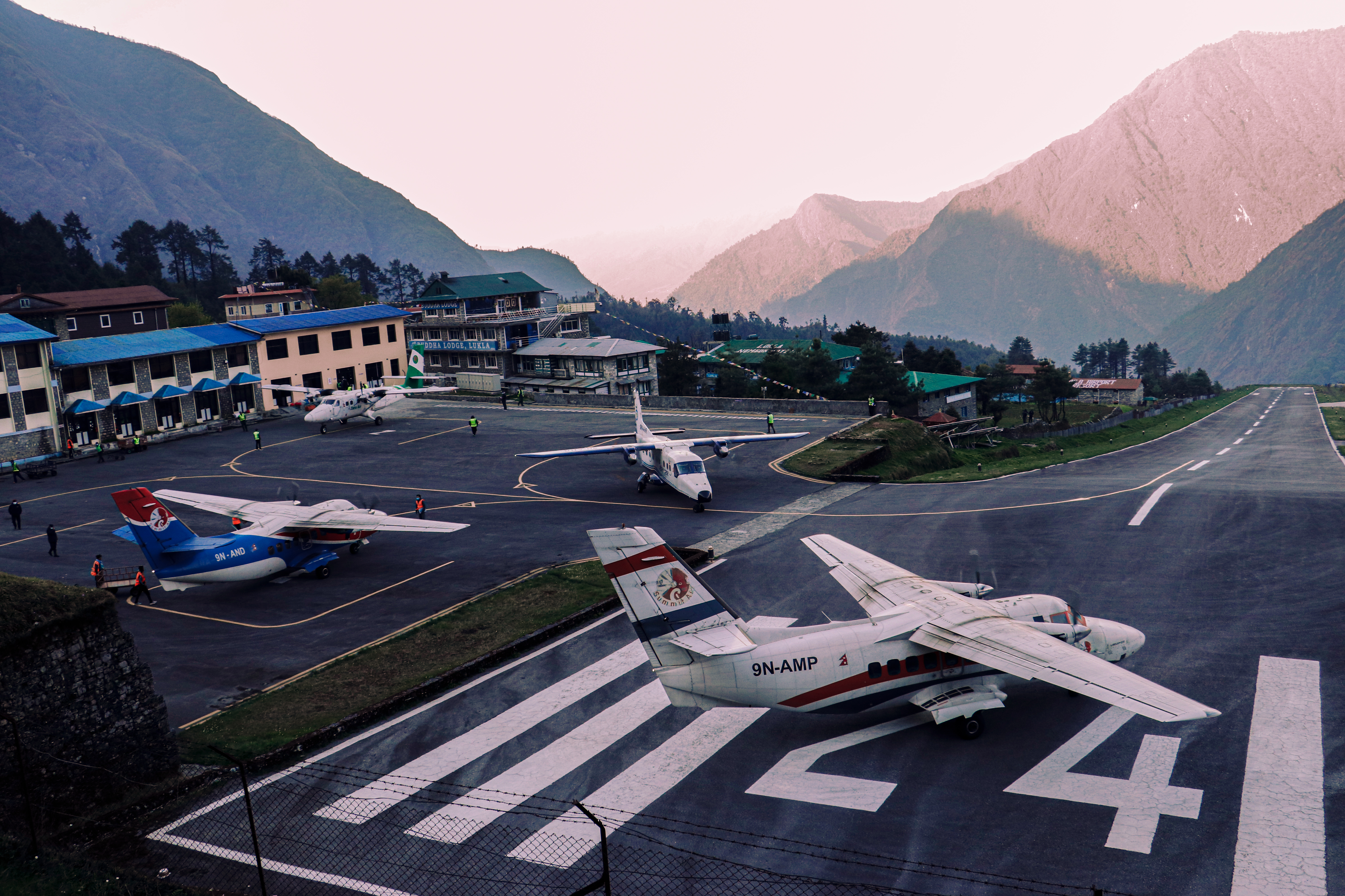
Domestic flights are often necessary to access trailheads or move between sections of the GHT. Popular flight routes include Kathmandu to Lukla (for the Everest region) and Kathmandu to Tumlingtar (for the Makalu-Barun region). It is important to note that domestic flights can often be delayed or canceled due to unstable weather, particularly in mountainous areas. Trekkers should build flexibility into their schedules to accommodate any changes.
Local Bus Systems
For lower-altitude sections of the GHT, local buses provide an affordable means of transportation. However, the buses are often crowded, slow, and uncomfortable. For more remote regions, jeeps can be hired to travel to the trailheads, but these are considerably more expensive.
9. Overall Budget and Cost
The cost of trekking the GHT varies greatly depending on the route chosen, the number of guides and porters hired, and the type of accommodation. The High Route, which involves more camping and remote trekking, is generally more expensive than the Low Route. Here is a breakdown of potential costs:
- Permits: $200-$500 depending on the regions visited.
- Guides/Porters: $25-$50 per day for a guide; $15-$30 per day for a porter.
- Accommodation: $5-$20 per night in teahouses; free when camping.
- Food: $10-$25 per day depending on the region and availability of guesthouses.
- Domestic Flights: $100-$200 depending on the route.
- Overall, the cost of trekking the GHT can range from $8,000 to $15,000 for the entire journey as per your expenses.
10. Solo Trekking: Can you trek the GHT alone?
No, it is not recommended to trek the GHT alone. Even Though some of the sections of GHT can be possible alone, solo trekking in the remote areas is not recommended. Solo trekking is clearly prohibited in some restricted regions, and having a guide is mandatory.
Furthermore, hiring a guide helps mitigate the risks of injury, high altitude sickness, getting lost, language barrier or facing extreme weather. For trekking trails like the Great Himalayan Trail, it is highly recommended to join a group for more safety and logistical reasons.

Conclusion
The Great Himalayan Trail (GHT) offers an unparalleled trekking experience that challenges adventurers to push their boundaries while immersing themselves in the raw beauty of Nepal’s remote landscapes. Whether you choose the high-altitude route for breathtaking views or the lower route for cultural richness, the GHT is a journey of a lifetime. It not only tests physical endurance but also provides a deep connection with nature, local communities, and ancient traditions. As one of the longest and most diverse trekking routes in the world, the GHT continues to captivate the hearts of trekkers, making it a must-do adventure for those seeking an epic and transformative experience in the Himalayas.

.jpg)
/potter.jpg)


/Trek to annapurna circuit.jpg)


