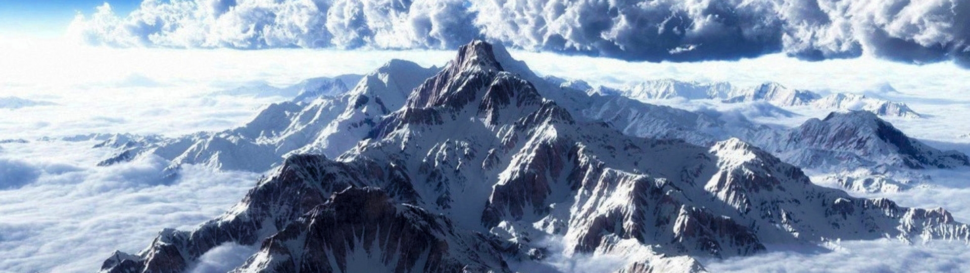
Nepal is home to eight of the world's 14 highest mountains, all towering over 8,000 meters, with Mount Everest being the tallest at 8,848.86 meters (29,031.69 feet). Additionally, Nepal boasts 72 peaks above 7,000 meters and over 1,300 peaks that exceed 6,000 meters, making it unique compared to other regions. This raises a common question: Why does Nepal have so many mountains?
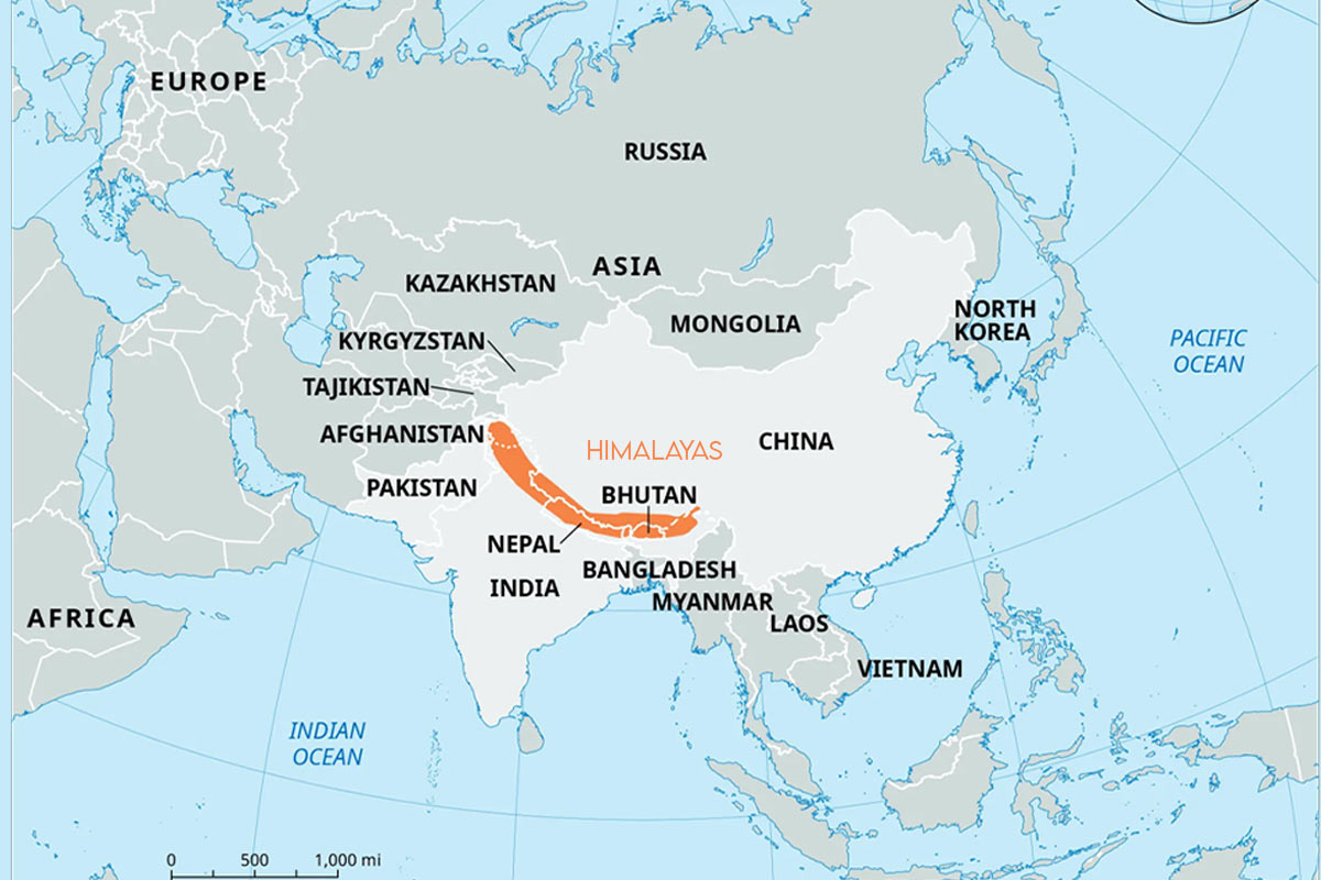
The answer lies in Nepal’s location within the Himalayas, home to ten of the world's highest mountains, with the remaining four in the Karakoram range. The tectonic activities shape Nepal’s landscape. Around 40 to 50 million years ago, the Indian Plate collided with the Eurasian Plate. Since both plates were made of relatively low-density material, they didn’t sink but folded, forming the mountain ranges we see today. This event also closed the ancient Tethys Ocean, leading to the creation of the Himalayas.
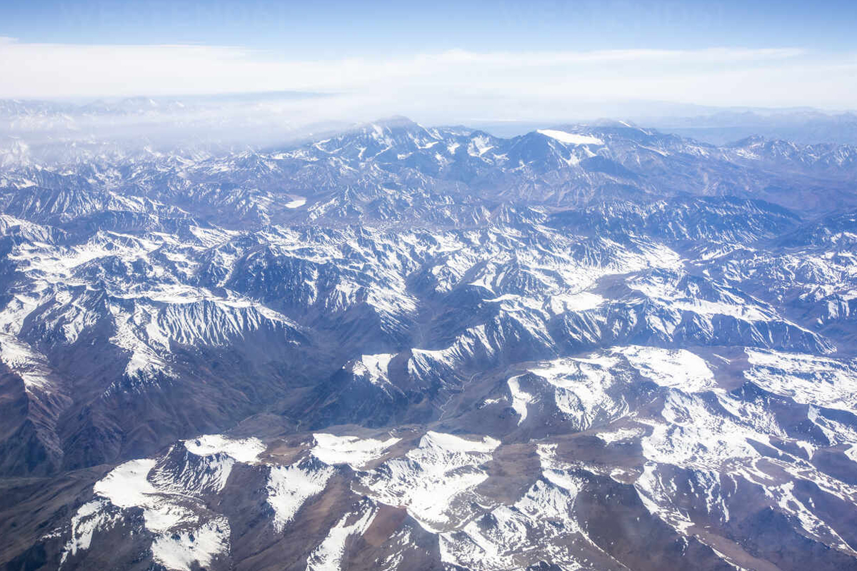
This ongoing collision between the Indian and Eurasian plates continues to shape Nepal’s landscape, causing the Himalayas to rise by about 2.4 inches each year. Over millions of years, this slow but steady movement has elevated Mount Everest to its current height, and research suggests that the Himalayas could rise even further in the coming millennia. In the next 10 million years, the Indian Plate is expected to travel an additional 1,500 kilometers into Asia, continuing to reshape the region.
In addition to its geological factors, Nepal's mountains are significant due to their cultural and religious importance. Many peaks are considered sacred in Hinduism and Buddhism, making them destinations for pilgrims as well as adventurers. These majestic mountains, combined with the country's diverse landscape of valleys and rugged terrain, play a crucial role in Nepal's tourism industry. Mountaineers and trekkers from around the world are drawn to Nepal to experience its unique topography and the spiritual aura surrounding these towering peaks.
Furthermore, Nepal's mountainous geography creates challenges, such as frequent earthquakes due to tectonic activities, and the dramatic shift in elevation from the lowlands to the high Himalayas influences the lives of those living in the region. Despite these challenges, the mountains remain central to the country’s identity, providing not only stunning scenery but also a deep cultural connection for the people of Nepal.
Nepal's unique location and Geological history of Nepal
Nepal is geographically situated in the lap of the Great Himalayas and its geology has shaped the country as one of the most active and growing mountain ranges globally. Tectonically, Nepal is located right between the Indian and Eurasian tectonic plates and is therefore still active. With the gradual northward movement of the Indian Plate, it displaces the Himalayas upward and southwards, thereby slowly and constantly re-organizing the geography of the area.
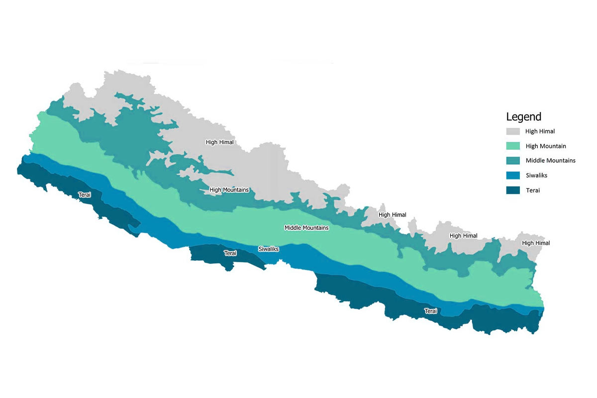
Geologically, Nepal is divided into five major tectonic zones: These physiographic regions are the Terai, the Siwalik Hills or Churia Range, the Lesser Himalaya, the Higher Himalaya and the Tibetan-Tethys Himalaya. These zones are marked by prominent faults such as the Main Central Thrust (MCT) and the Main Boundary Thrust (MBT) that differentiate the rock types, geologic age, and tectonic activity.
The Terai Zone is located in the south plain region while the second major physiographic zone is the Siwalik hills which is composed of loose sediments such as sandstone and conglomerate. These younger formations are also the result of the current natural processes which are still taking place to date. To the north, the Lesser Himalaya is predominantly made up of older sedimentary formations including limestone and sandstone. Above this, there is the Higher Himalayan Zone of harder granite and metamorphic formations and the tallest peaks such as Mount Everest, Kanchenjunga, Lhotse, Makalu, Annapurna, Dhaulagiri, Manaslu, Cho Oyu, Nanga Parbat and some many mountain ranges in Nepal. The Northernmost part of the Tibetan-Tethys Zone consists of ancient rocks of Tethys Sea origin giving an interesting insight into the geological history of the zone.
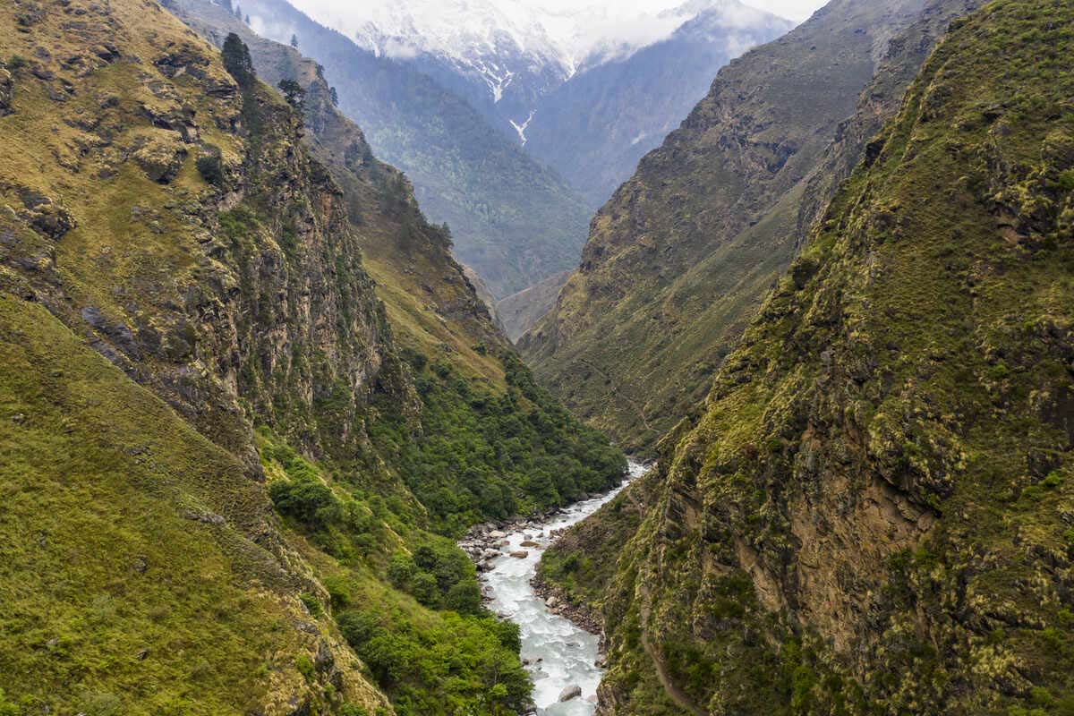
Nepal’s physiographic provinces are also formed by major rivers such as Koshi, Gandaki, and Karnali that have their origin in the mountains and flow through the valleys and gorges in the plains. This interplay of rivers and tectonic zones has made up a very complex topography of Nepal that has taken millions of years to form naturally.
How Himalayan Range form?
The Himalayan Range is one of the youngest and the highest mountain ranges on the Earth formed roughly 50 million years ago and till today is still growing. The process of formation of these mountains involved the collision of the Indian subcontinent with Eurasia which led to the formation of the Himalayas.
The events of the story can be traced about one hundred million years back when the supercontinental Gondwana began to split apart. The Indian plate moved quickly northward at a rate of 15 centimeters per year, due to the spreading of the Indian Ocean floor and the sinking of the oceanic crust. As it moved, it headed toward Eurasia. This movement gradually led to the closure of Tethys Sea which had once separated the two landmasses. The Indian plate pushed the ocean floor under the Eurasian plate, which led to the creation of volcanic islands.
When the collision between the Indian and Eurasian plates occurred, neither plate could sink beneath the other due to their lightweight continental crusts. Instead, the impact caused the Earth's crust to fold, and thicken, pushing the land upward and forming the towering mountains. This pressure also uplifted the Tibetan Plateau.
The collision formed key geological features such as the Main Central Thrust (MCT) and the Main Boundary Thrust (MBT), major fault lines running along the length of the Himalayas. These fault systems, along with others, shaped the mountain range.
The weight of the newly formed mountains caused the Earth's crust to sink slightly into the mantle, helping maintain the mountain heights, including Mount Everest at 8,848 meters above sea level. At the same time, rivers like the Indus, Ganges, and Brahmaputra carried sediment away from the mountains, forming the plains below.
Even today, the Indian plate continues pushing northward by about 5 centimeters per year, causing the Himalayas to grow and triggering frequent earthquakes in the region. The Himalayas' formation also significantly affected climate patterns, with the range acting as a barrier that influences South Asia's monsoon seasons.
Tectonic activity in Nepal
Nepal has always been in a very vulnerable position due to earthquakes as the Indian Plate constantly thrusts under the Eurasian Plate. This movement accumulates stresses that are periodically released in the form of earthquakes. The formation of the Himalayas through tectonic activities has made Nepal to be one of the most prone to frequent earthquakes globally.
Nepal is one of those countries that are very prone to earthquakes. Most of them are small and cannot catch attention, but a few shakes have led to destruction. One of the worst accidents to happen in recent years was the Gorkha earthquake in 2015, having a magnitude of 7.8, which took almost 9,000 lives and destroyed most parts of the country.
Nepal has a history of several major earthquakes. A severe earthquake in 1255 completely demolished the Kathmandu Valley, another in 1505 hit western Nepal, and one in 1833 struck central Nepal. Added to these is the 1934 Bihar-Nepal earthquake, which had a magnitude of 8.0 and caused further damage.
Large earthquakes in Nepal usually happen when the Indian Plate slips beneath the Eurasian Plate. Such earthquakes are referred to as "thrust" earthquakes and occur along major lines of weakness, such as the Main Frontal Thrust. Seismologists have indicated points where a large earthquake is overdue, including something called the Western Nepal Gap.
The sizes and frequency of earthquakes in Nepal vary. Major earthquakes with magnitudes of 8.0 or above happen once every 500-1,000 years. Major earthquakes of between 7.0 and 7.9 happen approximately once every hundred years, while moderate quakes occur at several per decade. Smaller earthquakes of lesser magnitude happen almost every month.
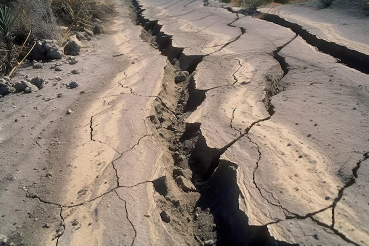
Other natural hazards include landslides, which always almost create threats in Nepal. Landslides usually occur in hilly and mountainous areas, especially after heavy rainfall or seismic activities. Earthquakes may cause liquefaction of the ground in the Terai area, which would render the earth unstable to stand on.
Effects of geological activity on Nepal's landscape
Geological activity in Nepal has played a major role in shaping Nepal’s landscape formation. The ongoing collision between the Indian and Eurasian plates has given rise to the majestic Himalayan mountains, including iconic peaks like Mount Everest, Kanchenjunga, and Annapurna. This tectonic movement continues today, causing the mountains to grow by a few millimeters each year, constantly altering the region's elevation.
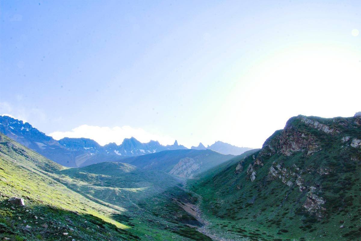
Geographically, Nepal can be divided into three major regions all of which have geological origin. The southern Terai region comprises flat plains formed by progressive accumulation of sediments from the Himalayas. That is why Terai is considered to be the most productive agricultural zone in the country. Northwards, the first set of hills or the Siwalik hills make the first range of elevated terrain. These hills consist of sedimentary rocks that erode very easily thus are more susceptible to landslides. Further north are the Middle Hills and High Mountains that consist of Mahabharat Range and Himalayas respectively. This area contains steep valleys, glacial blue lakes and high steep mountains which are as a result of the tectonic movement and deformation of rocks in this region.
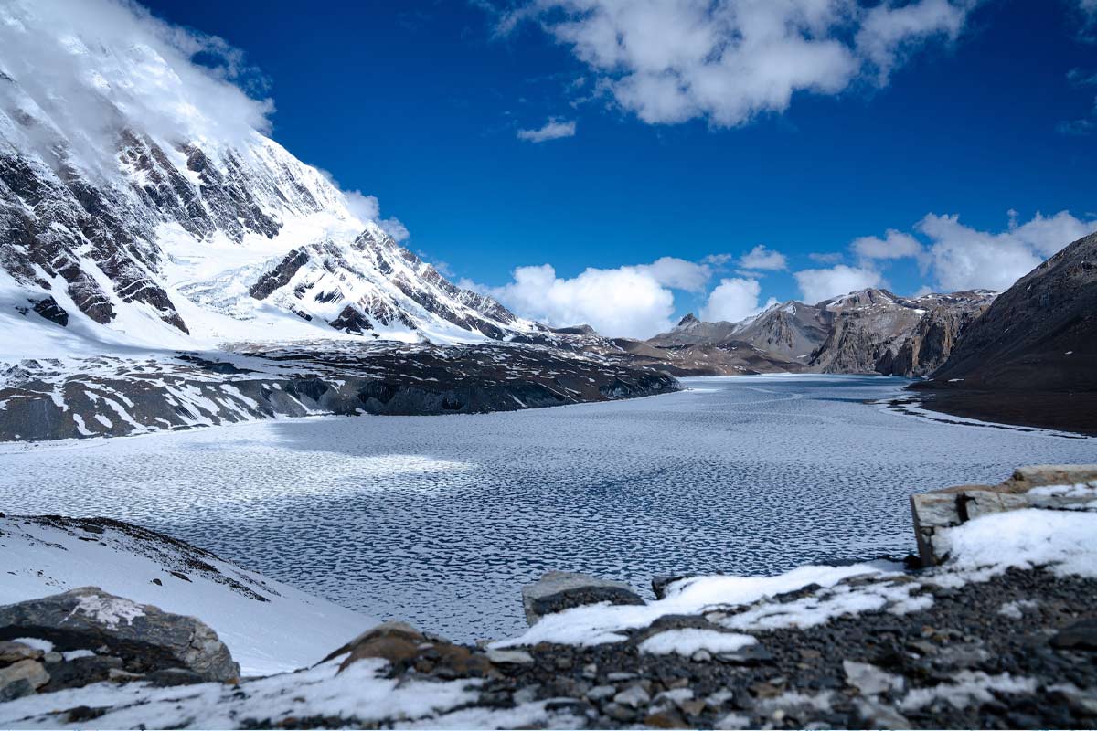
The major rivers that flow through the country include the Koshi, Gandaki and Karnali rivers have similarly been formed through geological forces. These are the rivers which start from the Himalayas and flow through the plains and have cut some of the deepest valleys in the world across the Great Himalayan Range. Apart from that the high altitude glaciers have also played their part as they have carved out U-shaped valleys and other features. Climate change also brings about glacier melting and development of new lakes as well as changes in the existing geographical map.
In Nepal, erosion plays a big role, particularly during the monsoon season. This rapid uplift combined with heavy rainfall events results in very intense erosion that moves large amounts of sediments to the lowlands. Consequently, the valleys are continuously being reshaped and alluvial deposits develop at lower regions.
Other effects of the geological activity include landslides. The steep nature of Nepal, together with frequent earthquakes and heavy rainfall, makes the country very prone to landslides. These block rivers, forming lakes that last for a short period of time, and reshape whole hillsides. In some instances, these landslides create natural dams which burst and cause floods, drastically changing the valleys below.
The geothermal activity has also brought about hot springs throughout Nepal. Most of the springs lie along fault lines and are attributed to therapeutic properties by the locals and tourists alike visiting these springs. Besides hot springs, areas with heavy limestone in Nepal-mostly the Mahabharat Range-develop karst landscapes. It has formed caves, sinkholes, and underground drainage systems.
Some lakes in Nepal, like Rara Lake and Phewa Lake, were formed by tectonic depressions caused by geological movement. These lakes not only add to Nepal’s scenic beauty but also support diverse aquatic ecosystems. The varied geological processes in Nepal have also contributed to the formation of different soil types, from the rich alluvial soils in the Terai to the thin, rocky soils in the high mountains.
Conclusion
For millions of years, large slabs of the earth’s surface have moved and lifted the land, which formed the magnificent Himalaya Range. This process goes on, gradually though constantly, altering the Geography of Nepal.
It is these geological forces that have gone further to create mountains. They have also created deep valleys, made rivers flow, and they determine the type of soil different regions possess. This variation in landscape affects most of the aspects of life in Nepal, from where people are able to grow crops to how they construct their homes.
While these natural processes create a landscape of beauty to which tourists from around the world are drawn, they also bring their challenges. The same forces that can give rise to mountain building can also trigger earthquakes and landslides, and it is these risks that the people of Nepal have had to adapt themselves to over generations.